About Us
Longstone Community Council was one of the first community councils established in Edinburgh (in 1980).
Its area covers most of the parish of Slateford/Longstone, bounded by the Water of Leith to the south and east and by the Murray Burn to the north. It includes Hailes Quarry Park but not Kingsknowe Golf Course. Apart from Longstone, it includes Redhall, Slateford, Kingsknowe, and the Dovecots south-east of Lanark Road, including Dovecot Park. It also includes Redhall Park (see map below).
All the parks in its area are the sites of former quarries, filled with City refuse.
The area is bisected by the main Edinburgh-Carlisle railway, with a halt and a level crossing in Kingsknowe. It is also bisected by the Union Canal.
The Community Council meets on the second Monday of the month, except for January, April, July, and August, usually at 7:30 pm in Slateford/Longstone Church. The Community Council is funded by grant from the City of Edinburgh Council.
History of the parish and a map.
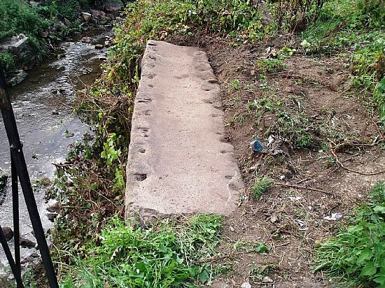
Longstone is named after the long slab of stone that used to act as a pedestrian bridge over the Murray Burn behind the Longstone Inn until it was replaced by a new bridge in the 1930s. In 2022 this stone, or a part of it, was uncovered (see photo below). It was being used as a coping to part of the north bank of the Burn beside the existing bridge. If anyone has a picture of the old stone slab bridge (photo or sketch), please let us know.
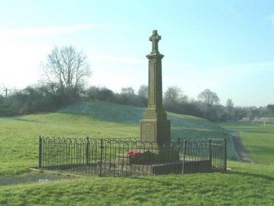
The Slateford/Longstone War Memorial in Redhall Park, which is 'Supplementary to the Colinton Memorial'.
For more details on the war memorial and a 'list of the fallen' commemorated on it.
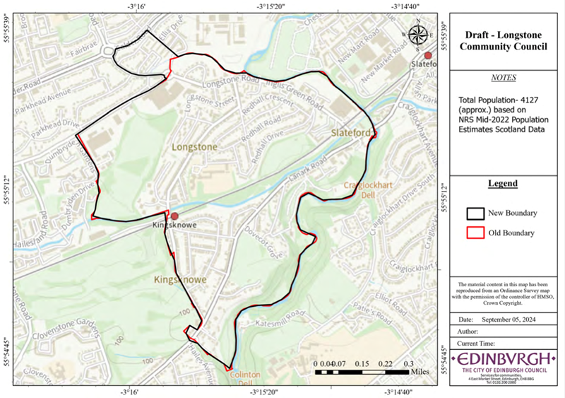
The black line outlines the LCC area (most of the parish) and the railway line separates Sighthill/Gorgie ward to the north from the Fountainbridge/Craiglockhart ward to the south. The LCC area increased in Feb 2025 to include Longstone View, Gardens and Terrace.